North Umpqua River
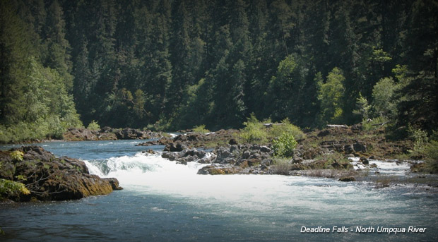
The North Umpqua River originates in Maidu Lake in the Cascade Range. The 34-mile stretch from Rock Creek to Soda Springs Dam is protected as a Wild & Scenic River. The scenery is a mix of rugged canyon walls, towering Douglas firs, and mossy forests, hung with lichen. One of the most unique things about the Umpqua is the aqua-clear water: the underlying lava rock filters all the water before it reaches the river.
The North Umpqua is spring fed and has ample flows throughout the summer. Rapids are short, steep pool drops with some Class IVs on the lower river section. This is prime spot for fishing summer steelhead and spring chinook salmon. Many consider the rapids to be quite technical, so this is great place for the intermediate boater to work their skills.
There are many campsites and access areas, which open up options for a variety of runs. During busy summer and holiday weekends, sites go fast, and beware of some boater limitations on the lower river. Check with the Forest Service for the most up-to-date info on these restrictions.
The South Fork of the Umpqua is also a great option for paddlers, particularly in the spring during high snowmelt runoff. This section of river originates in the foothills of the Cascade Range, near the upper Rogue River, and offers steep vegetated banks on the upper section and pastoral farmland scenery on the lower.
Directions: 23 miles east of Roseburg on Highway 138 (Rogue-Umpqua Scenic Byway).