Clackamas River – Fish Creek to Bobs Hole
When paddlers refer to the Upper Clackamas they mean the waters upstream of North Fork Resevoir which is part of PGE’s hydropower facilties on the river. The run from Sandstone Bridge (Three Lynx) down to the Memaloose Weigh Station just above the reservoir makes a great 13.5 mile day trip although many kayakers focus on the 4.2 mile middle section from Fish Creek to Bob’s Hole which serves up the best whitewater and some fine playboating.
One of the most popular rivers that our customers use our equipment on is the beautiful Clackamas River in Estacada, Oregon due to its proximity to Portland. It offers diverse sections that cater to a variety of skill levels.
UPPER CLACKAMAS
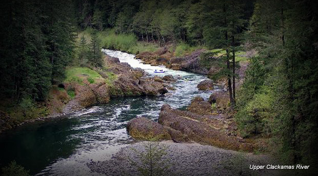
The Upper Clackamas, from Fish Creek to Bobs Hole, is hugely popular for rafters and kayaker alike. It’s packed full of class III-IV rapids and requires moderate to advanced skill to run. This is a run that is essential to have the right gear for in order to have a safe and enjoyable time. The one rapid to pay particular attention to is Hole in the Wall but don’t let it scare you from experiencing the amazing run on this part of the Clackamas. For a longer run of similar rapids, you can start at Indian Henry Campground which is above Powerhouse Rapid on the map below.
In the map, the river flows downstream starting from Powerhouse and ends at Bob’s Hole. Check out this Upper Clackamas Guide or the description in American Whitewater to find out more about each rapid.
We recommend using our Tomcat Solo or Tandem for this stretch of the Clackamas.
Check out this interactive map showing the run from Fish Creek Bridge down to Memaloose bridge: